The quick version
- The flight launches from Coronet Peak, the ski field on the range immediately north of Queenstown, reached by a switchback road up from the valley.
- A van collects you from the Skytrek desk on Camp Street and drives you up to Coronet Peak, about twenty minutes each way, included in the booking.
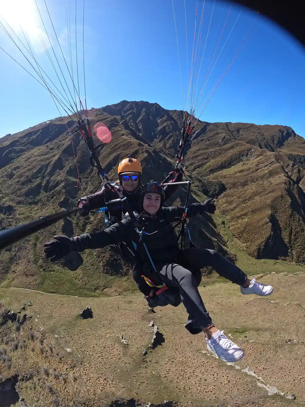
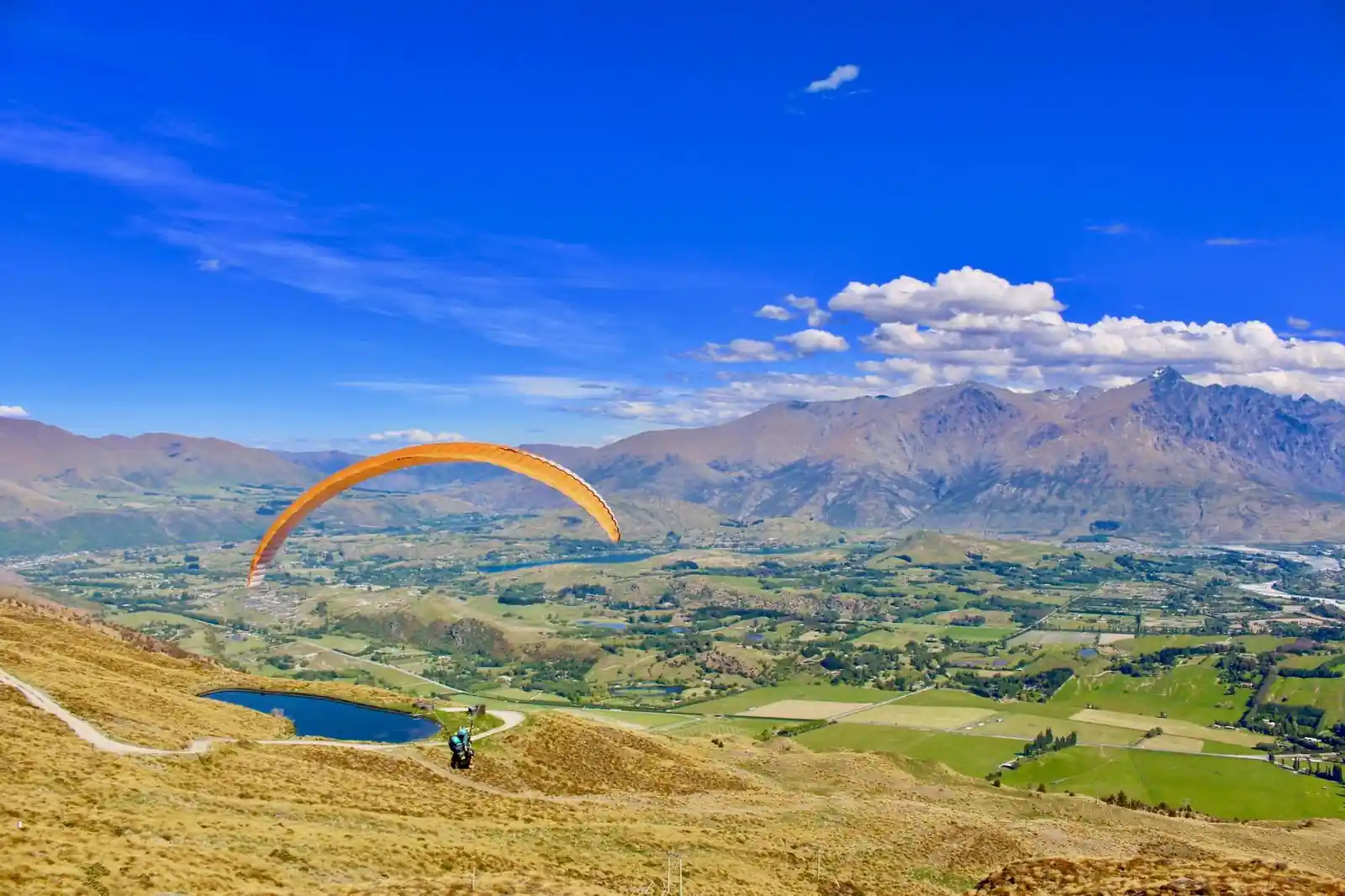
- From the top you look down over the Wakatipu basin, Lake Wakatipu, and the Remarkables range on the far side of the water.
- Queenstown has more than one place to paraglide from. This particular flight launches from Coronet Peak.
The Launch Site North of Queenstown
The flight for this trip launches from Coronet Peak, not from Queenstown itself. Coronet Peak is the ski field on the range immediately north of town, and getting to the launch is part of the day: a switchback road climbs out of the valley floor and up onto the mountain, gaining height through a series of tight turns that most visitors only ever associate with the ski season shuttle.
In winter, Coronet Peak is a working ski area with lifts and a base building. Outside the snow months, that same access road and the open ground near the top make it a workable launch for tandem paragliding: wide enough for a safety briefing, clear enough for a pilot to read the wind, and high enough above the valley to be worth the drive.
Getting Up There by Van
You do not walk or drive yourself. The trip starts at the Skytrek desk inside the Ziptrek shop on Camp Street in central Queenstown, and the transfer up to Coronet Peak is by van, included in the booking. It takes about twenty minutes, following the same switchback road described above.
That drive is a real part of the ninety-minute booking, not a formality either side of it. Of the hour and a half, roughly forty minutes go on the two van legs up and down, another twenty on the safety briefing once you arrive, and twenty on the flight itself. Anyone planning their day around this trip should count the road time as time spent, not time saved.
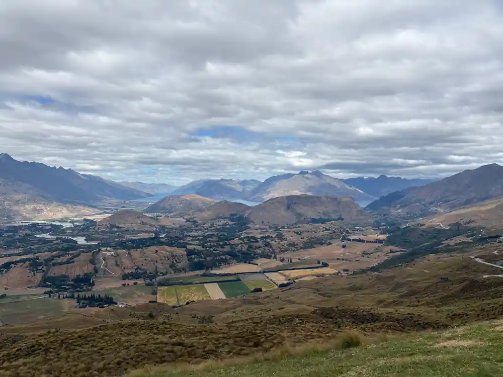
The switchback road up to Coronet Peak, seen from the Wakatipu basin below.
Why Launch From a Ski Field and Not the Valley
A paraglider needs air below it to fly, and the more of that air there is, the longer a flight can last before the wing has to come down. Launching from a ridge or a hilltop rather than flat ground is how tandem paragliding gets a flight worth taking at all: height is what turns a few seconds of gliding into a proper flight.
That is the whole reason Coronet Peak is used rather than somewhere lower and closer to town. A ski field sits on high ground by definition, cleared of trees for the pistes and open enough for a safe launch. Height is what makes a mountain launch the source of the best paragliding Queenstown has to offer, rather than a valley launch with barely enough air below it to matter.
The same logic explains why height matters more than which exact ridge is used. A flight that starts high has room to descend gradually, giving the pilot distance to work with and the passenger a flight that lasts minutes rather than seconds. A launch with no height behind it does not have that room, whatever else is around it.
What the Wakatipu Basin Looks Like From the Top
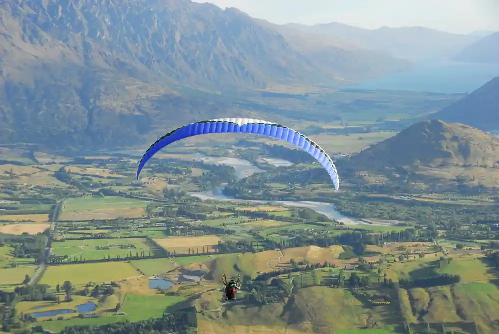
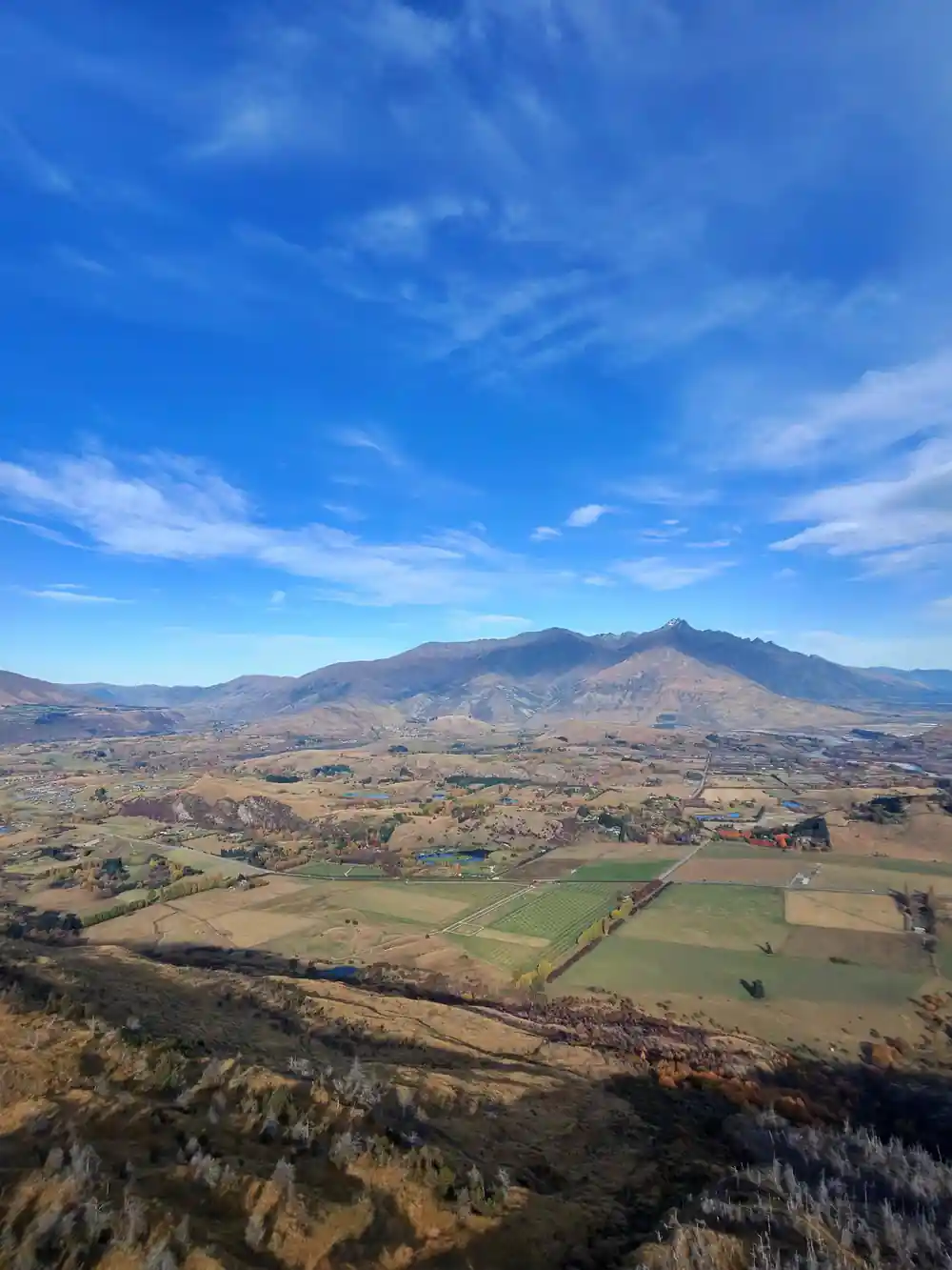
Queenstown sits inside the Wakatipu basin, a bowl of land ringed by mountains with Lake Wakatipu filling most of the floor. From a launch as high as Coronet Peak, that shape is visible in a way it never quite is from the streets of town: the lake stretching away, the built-up parts of Queenstown small against it, and the ridgelines closing the basin off on every side.
Across the lake, the Remarkables range forms the far wall of the basin, a long jagged line that gives Queenstown its skyline in every photograph taken from the water. Seeing that range from the air, rather than from the shore, is one of the reasons this particular flight is worth doing at all.
20 min
The van ride from central Queenstown up to Coronet Peak takes about twenty minutes and is included in the booking.
Landing, and the Drive Back to Town
A paraglider cannot land wherever it happens to be when the flight ends; it needs open, flat ground, and the pilot picks the landing to suit the day. On this trip that means coming down lower on the mountain rather than back at the exact launch point, well clear of the switchback road and the ski field buildings.
From the landing, the same van that brought you up meets you for the return leg. That drive back down to Camp Street takes about twenty minutes, mirroring the trip up, and closes out the ninety-minute booking where it started: at the Skytrek desk in central Queenstown.
One of a Few Places to Fly From in Queenstown
Queenstown has more than one spot people paraglide from; it is not a one-launch town. This particular flight uses Coronet Peak. The road up, the height it gives, and the view of the basin and the Remarkables all belong to that launch specifically rather than to paragliding in Queenstown, New Zealand in general.
If you are weighing up the best paragliding in Queenstown, the launch site is the detail worth asking about before you book: it decides the drive up, the view on the way, and the shape of the flight itself. The one used here is Coronet Peak, and nowhere else.
Different mountains work with different wind directions, which is part of why a town ringed by peaks on every side of its basin tends to end up with more than one place to fly from. None of that changes the flight in front of you: it launches from Coronet Peak, and that is the one worth understanding before booking.
Ready to fly from Coronet Peak above Queenstown?
from US$217Reserve now & pay later